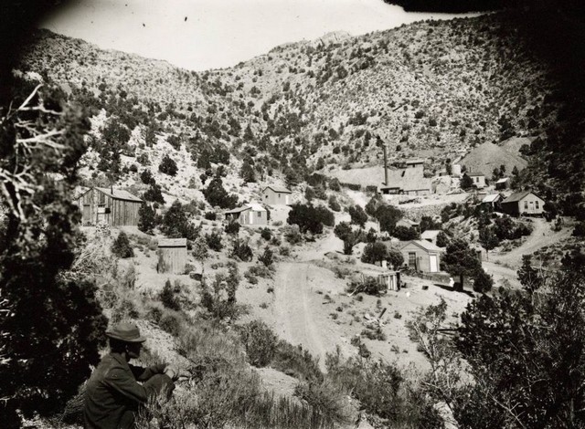
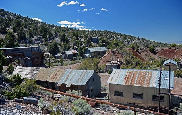
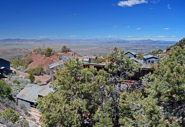
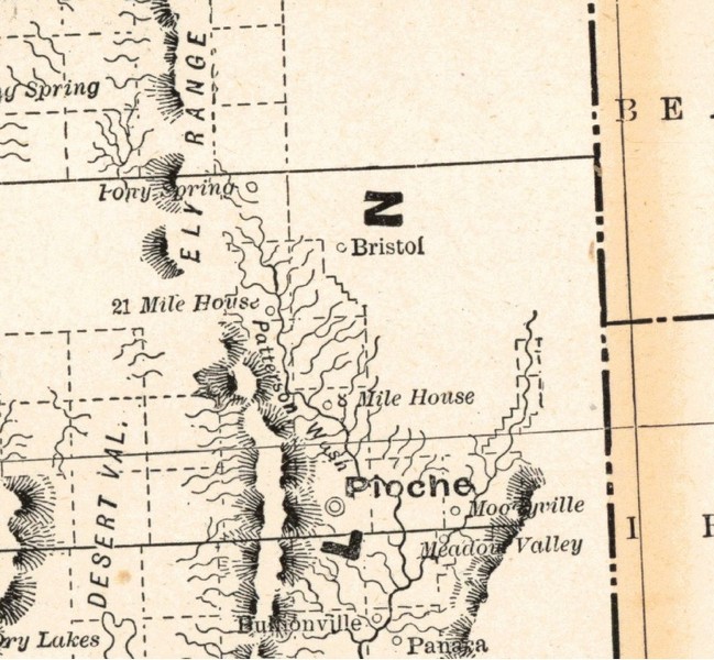
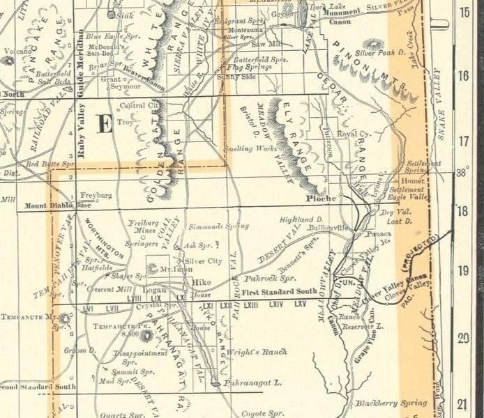
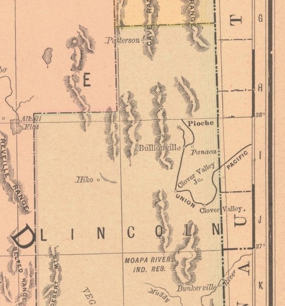
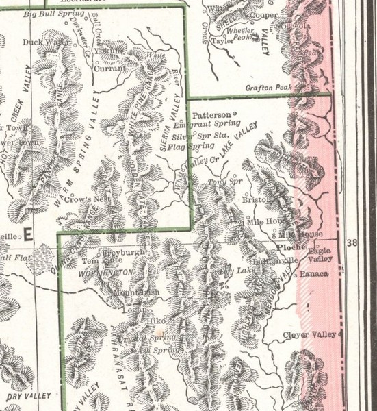

By 1878, the discovery of a richer ore deposit spurred further development. The settlement, renamed Bristol City, saw the construction of a stamp mill to crush ore, enhancing production capacity. The town's wells provided essential water for mining and smelting, supporting a growing community.
By 1890, a new smelter was constructed to process copper ore, reflecting a shift in mining focus as silver-lead deposits waned. This period marked the height of Bristol's economic and social activity, with infrastructure supporting both mining and community life. However, no known photographs from this era survive, limiting visual documentation of the town's peak.
C. V. Gilmer, of this city, has just marketed a carload of ore from the property of the Iron and Silver Consolidated company is Bristol District, Lincoln county, Nevada. The ore is high grade as it runs 30 per cent in copper besides carrying values in silver. At the present time Chicago people are negotiating for the purchase of this mine.
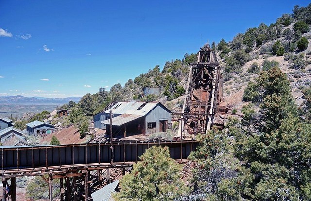
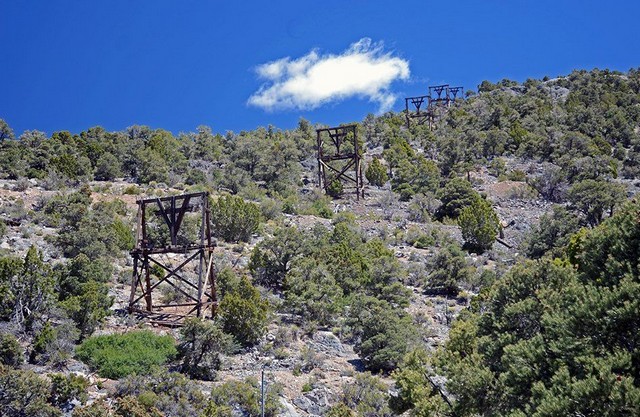
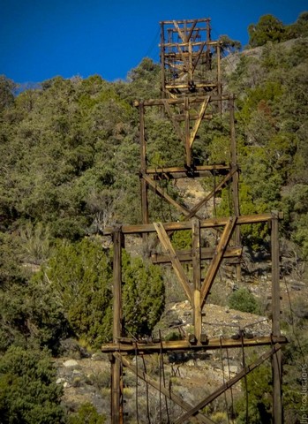
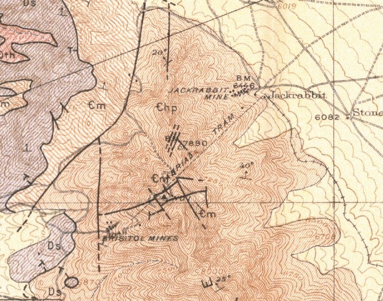
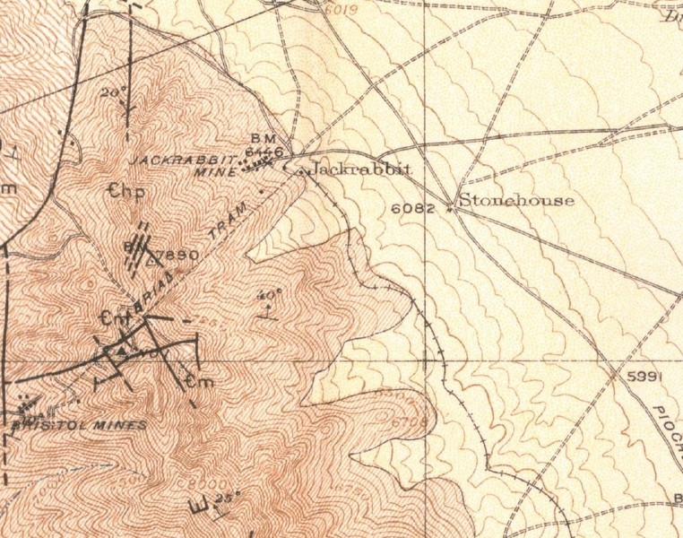
In 1913, an aerial tramway was constructed to transport ore two miles northeast to Jackrabbit, Nevada, where it could be loaded onto the Los Angeles and Salt Lake Railroad. This briefly boosted activity, but by 1918, mining had largely ceased, leaving Bristol nearly deserted. The town's wells and kilns remained as relics of its past industry.
Gold and Manganese
Mine Type ?
Surface And Underground Underground
Operation Type ?
1860
Year Discovered ?
1870's to 1940
Last Year of Production
Bristol Mine Near Caselton, Nevada
Name? Status?
Bristol Silver Mines Current
Owner Name and Address
Bristol Silver Mines Company
Type Owner-Operator
Kerr-Mcgee Corporation
Type Owner-Operator Stake Majority
Commodities
Notes
PYRITE (BELOW 1700 FEET)
ORE MATERIALS: GALENA, LEAD CARBONATE, SECONDARY COPPER MINERALS, SECONDARY ZINC, PLUMBOJAROSITE, MANGANESE OXIDES, SPHALERITE, MALACHITE, CHRYSOCOLLA, AZURITE, SMITHSONITE, CUPRITE, MELACONITE (TENORITE), SILVER CHLORIDE.
GANGUE MATERIALS: PYRITE (BELOW 1700 FEET) ., LIMONITE, HEMATITE, CALCITE, MANGANESE OXIDE, QUARTZ, CLAY GOUGE.
Deposit
DISCOVERY YEAR: 1960'S
INTERSECTIONS OF THE MAY DAY AND TEMPEST FISSURES. STOPING WAS PRACTICALLY CONTIGUOUS FROM THE MAY DAY COLLAR TO THE 1000 LEVEL OF THE SNYDER SHAFT.
IN 1942 THE PROPERTY CONSISTED OF 638 ACRES OF PATENTED LAND AND 1222 ACRES OF UNPATENTED LAND. THE BRISTOL SILVER MINES CO OWNED MOST OF THE MAIN WORKINGS OF THE DISTRICT BUT ONLY THE CENTRAL SNYDER, GYPSY & MAY DAY WORKINGS ARE HERE IN DESCRIBED. THE OTHERS ARE TREATED AS SEPARATE RECORDS.; INFORMATION SOURCE: 1 PUBLIC LITERATURE; 2 UNPUBLISHED REPORTS.
FIGURES GIVEN FOR AVERAGE LENGTH, WIDTH, AND THICKNESS ARE MEASUREMENTS OF ONE OF THE LARGEST ORE BODIES, AND REPRESENT THE MAXIMUM SIZE TO DATE.
FOUR MAIN VEINS ACCOUNT FOR THE BULK OF THE PRODUCTION IN THE BRISTOL DISTRICT: THE MAY DAY, TEMPEST, GYPSY-NATIONAL, AND THE LEAD-ZINC VEINS. THE ORE BODIES OCCUR ALONG FRACTURED ZONES, IN BRECCIATED AREAS AND IN INTERSECTING FISSURES. THE MAIN FISSURE SYSTEM (THE MAY DAY) RUNS E-W. THE TEMPEST ALSO RUNS ABOUT N80E, BUT THE TEMPEST DIPS 70E, WHILE THE MAY DAY DIPS 45E. THE GYPSY-NATIONAL SYSTEM STRIKES NE AND DIPS 70-85E, AND THE LEAD-ZINC VEIN STRIKES NW AND IS VERTICAL. THE LATTER TWO VEINS INTERSECT THE TEMPEST AND MAY DAY FISSURE, AND OXIDIZED ORE OCCURS IN LARGE BRECCIATED ZONES AT THESE INTERSECTIONS. SULFIDE ORE IS RARE, BUT SOMETIMES OCCURS AS NODULES WITH GALENA CORES ENCASED IN CERUSSITE, COATED BY CARBONATE WITH A FILM OF COPPER OXIDE. BEDDING CONTACTS AND FLAT BEDDING THRUSTS OFTEN LOCALIZE ORE DEPOSITION. OREBODIES ARE VERY IRREGULAR IN SIZE AND SHAPE. ORE IS VERY SOFT. SOME OF THE LARGER OREBODIES DEVELOPED AT INTERSECTIONS OF THE MAY DAY AND TEMPEST FISSURES. STOPING WAS ALMOST CONTINUOUS FROM THE MAY DAY COLLAR TO THE 1000 LEVEL OF THE SNYDER SHAFT. SEVERAL STRONGLY BRECCIATED ZONES NEAR FAULTS CARRY HIGH-GRADE COPPER AND LEAD ORE WITH SILVER. AT THE BLACK METAL MINE, THE ORE SYSTEM CONSISTS OF A VERTICAL PIPE FROM WHICH REPLACEMENT OREOBDIES EXTEND OUT LATERALLY AT 3 HORIZONS INTO THE GENTLY-DIPPING LIMESTONES THAT ENCLOSE THE PIPE. THE PIPE IS LOCALIZED BY BRECCIATION AT STRUCTURAL INTERSECTIONS. LEAD-SILVER ORE OCCURRED IN THE CENTER OF THE PIPE WITH EXTERIOR ZONES PROGRESSIVELY HIGHER IN MANGANESE AND LOWER IN LEAD AND SILVER.
Lincoln, Nevada
Notes
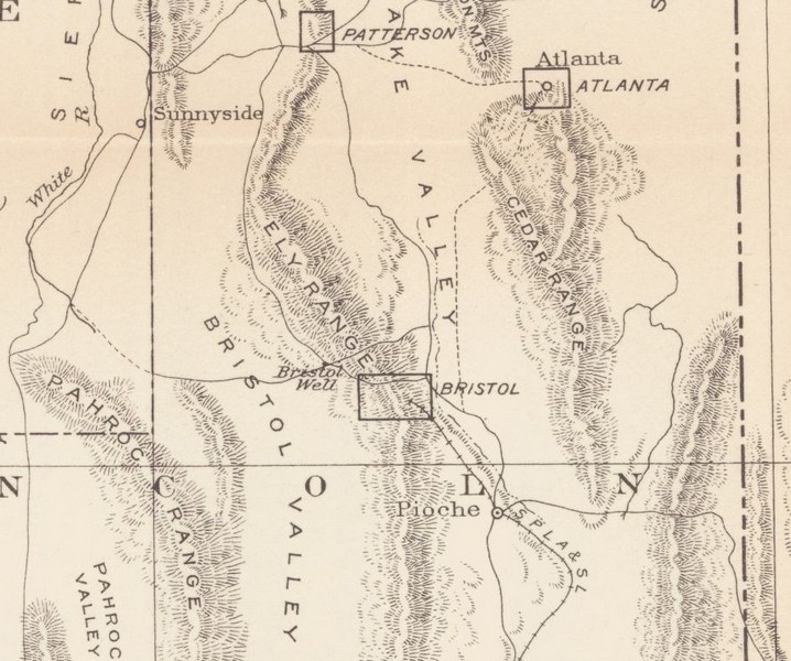
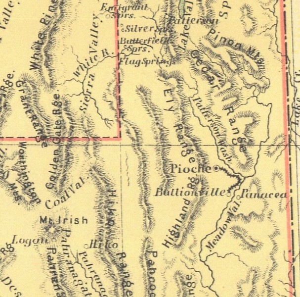
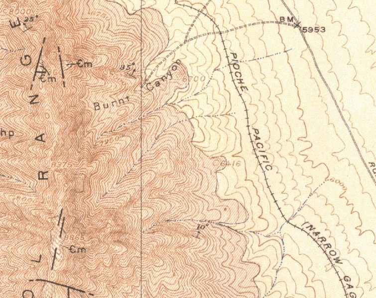
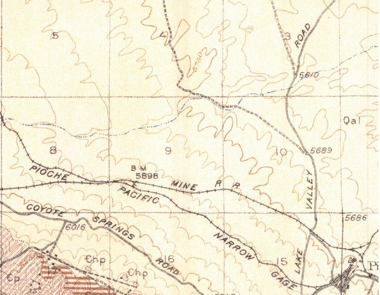
THE BRISTOL-JACKRABBIT MINES ARE SCATTERED OVER A FEW SQUARE MILES IN THE NORTH END OF THE BRISTOL RANGE NORTHWEST OF PIOCHE. THE JACKRABBIT MINES WERE ON THE EASTERN SIDE OF THE RANGE, AND THE BRISTOL MINES WERE JUST OVER THE CREST OF THE RANGE A FEW MILES TO THE WEST, BUT AFTER AN AERIAL TRAM WAS BUILT IN 1914 TO BRING ORE FROM THE BRISTOL MINES DOWN TO THE RAILROAD AT JACKRABBIT, THE HISTORIES AND PRODUCTION OF THE TWO AREAS WERE LINKED. MANY OF THE BRISTOL MINES ARE CONNECTED BY UNDERGROUND WORKINGS (SNYDER, MAY DAY, GYPSY). MINES ARE LOCATED ON BOTH SIDES OF THE CREST OF THE BRISTOL RANGE, WITH THE LARGER AND MORE PRODUCTIVE MINES ON THE WEST SIDE.
District
Bristol-Jackrabbit Mining District
Identification
THIS RECORD IS A NEW RECORD THAT INCLUDES ALL MATERIAL FROM EARLIER MRDS RECORD M242423 AS WELL AS ADDITIONAL INFORMATION FROM RECORDS ON ADJACENT PROPERTIES AND NEW INFORMATION.
DISCOVERY OF THE BRISTOL DEPOSITS PROBABLY DATES TO PRE-1870, ABOUT THE TIME THAT THE PIOCHE DEPSITS WERE DISCOVERED A FEW MILES TO THE EAST. PRIOR TO 1872, THE TOWN OF BRISTOL WELL OR BRISTOL CITY SPRANG UP ON THE WESTERN FLANK OF THE BRISTOL RANGE BELOW THE MINES. CHARCOAL OVENS NEAR BRISTOL WELL ATTEST TO EARLY PRODUCTION. A FURNACE WAS BUILT AT BRISTOL CITY ABOUT 1872 TO TREAT SILVER ORE FROM THE BRISTOL MINE AND A 5-STAMP MILL WAS BUILT IN 1880. ABOUT 1890, A NEW SMELTER WAS BUILT AND BRISTOL'S POPULATION WAS ABOUT 400. MINING ACTIVITY ENDED IN 1893 AND BRISTOL DECLINED UNTIL 1900, WHEN A LEACHING PLANT WAS BUILT TO RECOVER COPPER FROM THE ORE, BUT THAT ENDEAVOR WAS NOT VERY SUCCESSFUL AND BRISTOL DECLINED. THE DISCOVERY OF THE JACK RABBIT DISTRICT ON THE EASTERN SLOPE OF THE BRISTOL MOUNTAINS IS ATTRIBUTED TO THE LOCATOR PICKING UP A ROCK TO THROW AT A JACKRABBIT AND FINDING IT TO BE HIGH GRADE SILVER ORE. THE DISTRICT WAS LOCATED IN 1876 BY ISAAC NEWTON GARRISON. WITHIN MONTHS THE CAMP, AT ONE TIME NAMED ROYAL CITY, HAD A STORE, SALOON, BOARDING HOUSE AND RESTAURANT. EARLY MINE PRODUCTION WAS ABOUT TEN TONS PER DAY, CARRYING NATIVE SILVER IN FLAKES, YIELDING ABOUT $40 PER TON-SOMETIMES AS HIGH AS $2000 PER TON. TOTAL PRODUCTION OF THE DISTRICT IS ESTIMATED AT ABOUT $2,000,000 TO $6,000,000. MINE PRODUCTION DECLINED DURING THE 1880'S, BUT WHEN A FIFTEEN-MILE NARROW GAUGE RAILROAD WAS OPENED IN 1891 BETWEEN THE JACKRABBIT MINE AND PIOCHE, MINERAL PRODUCTION SOON INCREASED. AFTER 1893 THE MINES FELL SILENT UNTIL AFTER THE TURN OF THE CENTURY. IN THE EARLY 1900'S, THE DAY-BRISTOL CONSOLIDATED MINING COMPANY OWNED AND OPERATED THE MAIN BRISTOL SILVER MINES AND IN 1914 BUILT A 2-MILE AERIAL TRAMWAY FROM THE MAIN WORKINGS ON THE WESTERN CREST OF THE BRISTOL RANGE TO THE RAILROAD TERMINUS AT JACKRABBIT ON THE EAST FLANK OF THE RANGE. BRISTOL SILVER MINES CO. WAS ORGANIZED IN 1919 AND THEY PURCHASED THE JACKRABBIT-PIOCHE NARROW GAUGE RAILROAD. PRIOR TO 1926, BRISTOL OPERATED WITH GASOLINE ENGINES, THEN DIESEL ENGINES CONNECTED TO GENERATORS UNTIL 1937 WHEN ELECTRICAL POWER WAS OBTAINED FROM THE BOULDER PIOCHE POWERLINE. PRODUCTION AT THAT TIME WAS 3000 TONS/MONTH. BRISTOL SILVER MINING CO. OWNED MOST OF THE PROPERTY IN THE DISTRICT FOR SOME TIME DURING THE MOST PRODUCTIVE YEARS OF THE DISTRICT, THE 1920'S-1940'S. IN 1942 THE COMPANY'S PROPERTY CONSISTED OF 638 ACRES OF PATENTED LAND AND 1222 ACRES OF UNPATENTED LAND. KERR-MCGEE CORP. BRISTOL SILVER MINES OWNED THE PROPERTIES IN THE 1970'S AND UNTIL THE CURRENT TIME (2004) NDOM PERSONNEL ASSISTED KERR-MCGEE CORP. WITH AML FENCING DOCUMENTATION AT THE BRISTOL AND JACKRABBIT MINES IN 2004.
THE BRISTOL MINES WERE DEVELOPED BY EXTENSIVE UNDERGROUND WORKINGS. THESE INCLUDED THE MAY DAY SHAFT, TUNNEL, AND CROSS CUT; THE MAIN SNYDER SHAFT ON A 70'S INCLINE TO 1780 FEET IN THE 1940'S; AND THE VERTICAL GYPSY SHAFT. MAJOR STOPES ARE THE DAVE FOX STOPE, BINGHAM CANYON STOPE, BONANZA STOPE, CAVE STOPE, AND PERRY STOPE. A 2-MILE AERIAL TRAMWAY WAS BUILT FROM THE MAIN WORKINGS ON THE WEST CREST OF THE BRISTOL RANGE TO THE R
Copper
National Silver Mine
Silver
Vesuvius Gold Mine
Gold
Inman Copper Mine
Copper
Kismet Property
Zinc
Tempest Gold Mine
Copper
Inman Copper Mine
Copper
Kismet Property
Lead
Tempest Copper Mine
Copper
Nearby Places
Caselton (13.28 miles away)
Pioche (13.77 miles away)
Nearby Mining Districts
Bristol-Jackrabbit Mining District (0 miles away)
Silverhorn Mining District (4.25 miles away)
Highland Mining District (5.30 miles away)
Bristol (1878/1908)
Tempest (1922-1929)
Bristol Silver (1929-1932)
Bristol Silver (1936-1950)
The townsite was listed on the National Register of Historic Places in 1972.
Google Maps mistakenly identifies Bristol as the "Bristol Wells Ghost Town".
The first was started in 1872. Originally called the Pioche and Bullionville, it was reincorporated as the Central Nevada Railroad in 1873, and renamed the Nevada Central, though not related to the railroad near Ely. It went out of business in 1880.
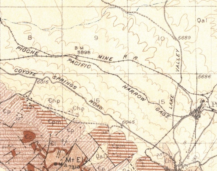
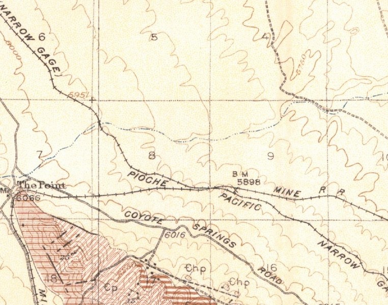
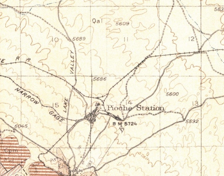
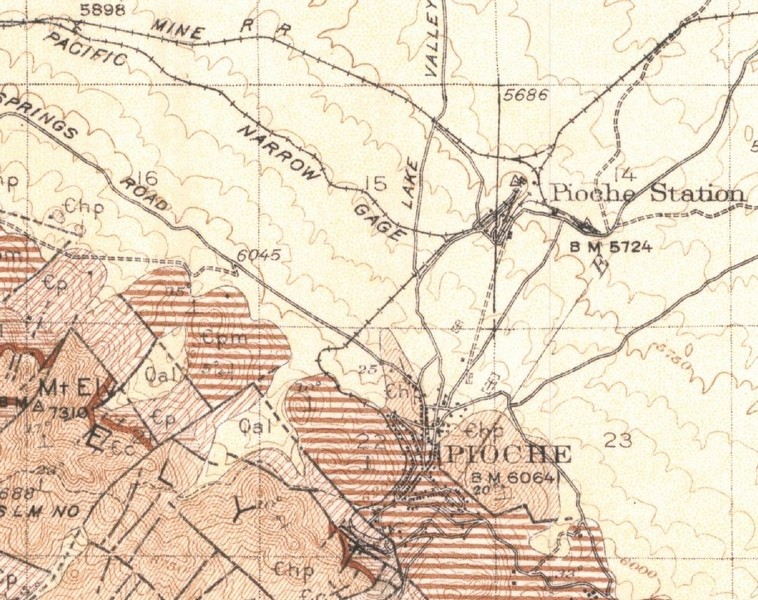
In 1889, the Pioche Pacific Transportation Company, known as the Jackrabbit Line, built a new narrow-gauge line. The Pioche Pacific connected with the Jackrabbit Mine to the east. It did not finally close until 1948.
Next was the Caliente & Pioche Railroad. It was built by San Pedro, Los Angeles, and Salt Lake Railroad starting in 1907, and connected Pioche to the outside world. It became part of the Union Pacific.
The final Pioche railroad was the Price Consolidated Railroad which began constructed in 1912. It too became part of the Union Pacific in 1940.
