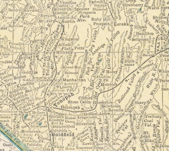
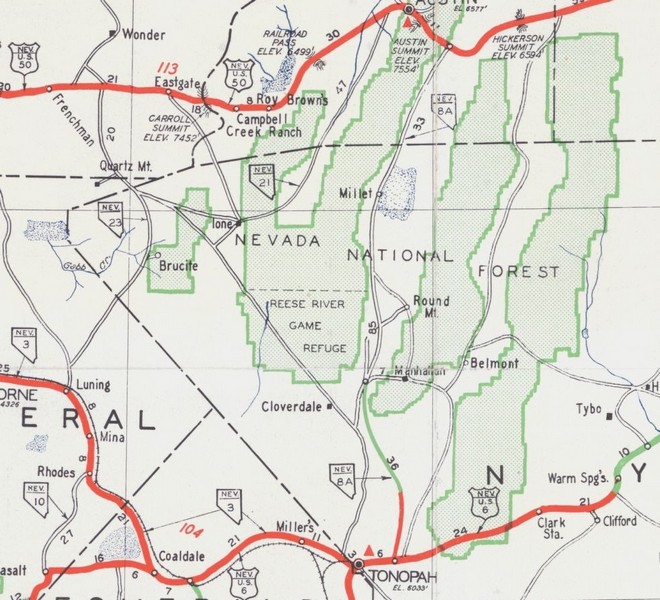

Nevada Central Railroad Co. One of the first plans to introduce rail service into the Tonopah region was the 1902 Nevada Midland plan whereby the Nevada Central would extend south from Austin. Neither that plan nor the Nevada Midland itself ever materialized, but the Nevada Central itself instituted surveys for a route to Tonopah in 1905.Declining mining activities at Austin torpedoed those plans. Although this was one of the earliest plans in the twentieth-century, in fact surveys were begun for a projected route southward from Austin as soon as the Nevada Central Railway was completed to the SP interchange at Battle Mountain in February 1880, some twenty years earlier. These plans were abandoned by the spring of 1881 when competition from the Carson and Colorado Railroad had a negative impact on the Nevada Central traffic and revenues.
A secondary mining boom took place in 1909, totaling a whopping $10 million in production before it ceased in 1947. Gold is still very prevalent in this region, too, with mining operations re-opened and continued in the 1970s and 1990s.
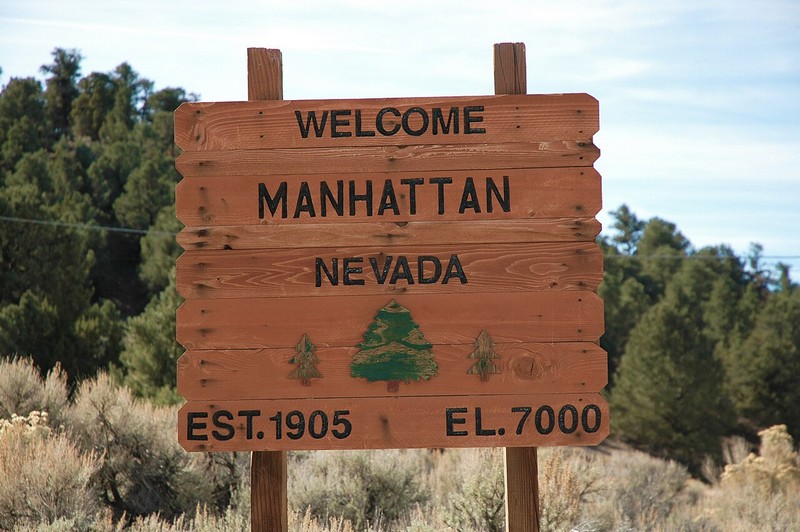
Today, around 125 people reside in Manhattan, enabling the esteemed pleasure of referring to themselves as living ghost town. Large-scale mining is currently in full swing in Round Mountain, a small town about 14 miles away where most residents undoubtedly go for amenities. Although there aren't many businesses still in operation, Manhattan has a leg up on nearby Belmont: it’s on the grid and tapped into electricity. When exploring this fascinating region dotted with many mining and ghost towns, plan to stay at Manhattan's only remaining establishment: The Manhattan Bar & Motel. Also, be sure to stop by the Manhattan church, prominently positioned on the hillside overlooking the former business district. Originally erected in Belmont during its former glory days, the church was 'stolen in the night' once prospecting had shifted to Manhattan.
After discoveries were made at Manhattan and Round Mountain in 1905, followed by those in the Toiyabe Range the next year, a new townsite was laid out adjacent to the ranch. It soon gained a post office, general store, saloons, blacksmith shop, wagon repair, and the two-story Lakeview Hotel. Another hotel, the Smoky Valley, was completed in 1909. At its peak, the area was home to around 300 and even had telephone service.
As mining soon languished, however, so did Millett. The population plummeted to fifty by 1911, and in 1923 the Milletts finally sold the ranch. The post office held on until 1930 in the old general store before finally closing itself. The ranch is still active, and some buildings remain including the original Scheel ranch house. Closer to the highway, two other ruins remain, though their origin is unknown to me.
Today Kingston is a small picturesque community that has a small permanent population. A few businesses are open, mainly serving visitors to scenic Kingston Canyon. A road to Big Creek was built by the CCC in the 1930s, and Groves Lake was created in 1969. The Forest Service maintains a campground about 2½ miles up from town, and several other primitive campsites are also present.
San Antonio was an important stage stop between Middlegate and Belmont constructed in 1865 and improved in 1879. A small town grew up around the site, serving mines in the vicinity, chiefly the Liberty Mine about 10 miles to the South. It evolved into the San Antonio Ranch after the station closed in 1910.
Older ghost town books mention the remaining adobe walls of the rather large Station standing by two poplars, but we didn't manage to locate anything other than the remains of the smelter and its bricks, and one small adobe wall attached to same, and the trunks of two very large trees that were cut down a long time ago. Could this be the remains of the station? Or has the station melted away entirely? Also nearby is the San Antonio Ranch, obviously occupied and used until very recently. We saw newspaper ads dated 2006, so unless people are bringing copies of Car Shopper with them and leaving them when they're done. We'll assume that's about when it was abandoned.
A mill is mentioned in other ghost town references but no mention of a smelter. The USGS map locates the "San Antonio Smelter" in the vicinity.
The ranch has several buildings standing; what appears to be an old school house, a mobile home of fairly recent vintage, a coupe of barn and generator out-buildings and tack room, an old house, and an older house. Lots of pipe corrals and fencing made with local sticks. Someone was trying to make a go of it but it's pretty bleak out here.
Gold was discovered at Round Mountain in 1905, but it was not until the following year that more substantial discoveries aroused interest in the area. High-grade gold ore was discovered on a hill known as Round Mountain. By mid-year, the population was close to 400. A number of major mining companies became active in the area and soon the town was given the name of Round Mountain. By 1907, there were daily stages running from Round Mountain to Tonopah. The town contained many wood structures containing mercantiles, saloons, brokerage agencies, a school and a library. In 1906, the first two mining companies to begin operations were the Round Mountain Mining Company and the Fairview Round Mountain Mines Company. The value of the ore produced by the Round Mountain Company during the first ten years (1906 to 1916) was a little over $3 million. By the beginning of 1909 there were six mills operating in the district. Businesses included hotels, general stores, banks, restaurants, lodging houses, a school, a library, and a hospital. By 1939 the town's population was still only 234. The value of total production through 1940 was $7.8 million. New surface operations on the side of Round Mountain began in 1970 and continue to this day.
Round Mountain is an unincorporated town in Nye County, Nevada, United States. The population of Round Mountain as of 2014 is 1,868. The town's ZIP code is 89045.
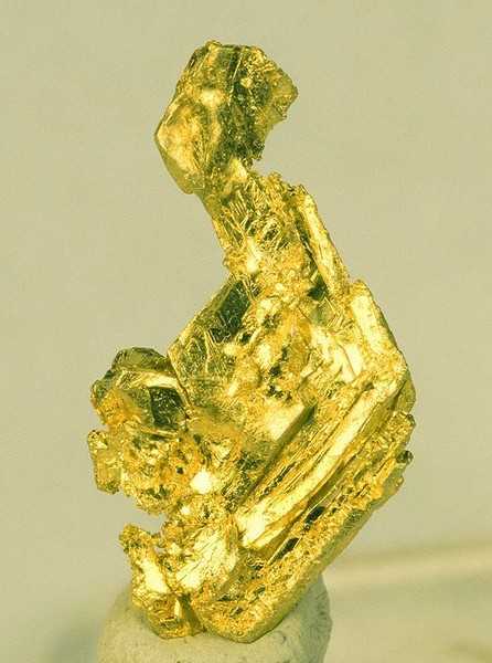
Round Mountain is best known for the Round Mountain Gold Mine, a large open pit heap-leach gold mine owned by Kinross Gold Corporation. The first gold production from the Round Mountain District was in 1906, and by 2006 the mine had produced over 10 million ounces of gold, worth about US$9.5 billion at 2009 prices. Ore reserves and resources total about 1.8 million ounces of gold as of the end of 2007. The gold occurs on the rim of an ancient collapsed caldera and is mainly fine-grained, with visible (and sometimes spectacular) gold occurring in structural intersections. While the original town of Round Mountain remains near the current mining operation, the construction of Hadley served, in essence, as a relocation of the former community. As such, and with the new town existing as of, by, and for Round Mountain Gold, the surrounding areas, including both towns (occasionally including the town of Carvers as well), are often generically referred to as Round Mountain.
